How to See Older Images in Google Maps
Getting nostalgic about old neighborhoods? You don’t need to wonder. You can view older images in Google Maps and take a virtual journey through time.
Have you ever wondered what a place looked like a few years ago? Perhaps you want to see how your neighborhood has changed or check out how a famous landmark looked before it was renovated. If you’re curious, you can use Google Maps to see older images of any location on Earth—as long as it has an older picture. That’s because Google regularly updates the photography it uses for Street View navigation.
If you want to check out older images in Google Maps, follow the steps below.
How to See Older Images in Google Maps on a PC or Mac
Street View allows you to travel through Google Maps as if you were walking or driving through different streets, giving you a more typical view of the history of your favorite areas. If you’re using Google Maps on a PC or Mac, you can quickly view older Street View images using a web browser on your PC, Mac, or Chromebook.
- Go to the Google Maps website.
- Type in the address or name of the location you want to view.
- Click the Street View in the bottom-left corner of the map. This will enable Street View for the map in your current location.

- Click on any of the blue paths on the map—this will show Street View imagery for that location.

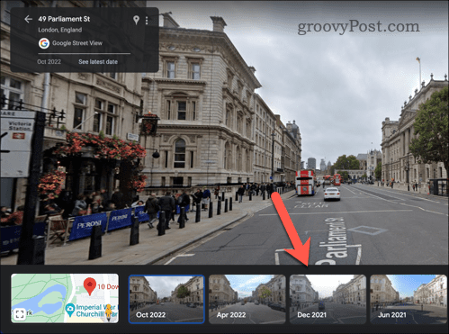
- Next, press See more dates in the information block in the top-left.

- From the bottom, drag the image carousel back and forth, then select one of the images to see how the location looked at different points in time.

- To exit, click the exit button in the top-right corner.


How to See Older Images on Google Maps on Android or iPhone
Using an Android or iPhone device, you can check out older Street View images using the Google Maps app.
- Open the Google Maps app and tap on the search bar at the top of the screen.
- Type in the address or name of the location you want to view, then select it when it appears in the suggestions list.
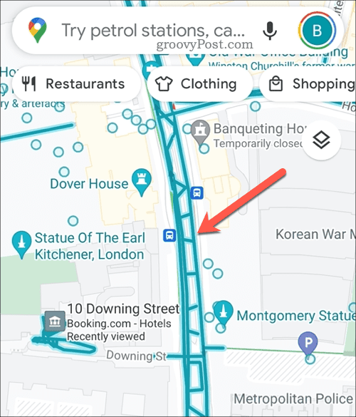
- Tap on Layers in the top-right corner (the icon with three stacked squares) and select the Street View icon from the menu that pops up.

- Tap and hold anywhere on the map where a blue line covers a road–you may need zoom in first.

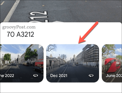
- Next, tap See more dates at the bottom.

- Swipe left or right across the screen at the bottom to see how your location looked at different points in time, then tap one of the alternative images.

- Navigate around the area to see how it looked in the past. When you’re ready to exit, tap the exit button in the top-left corner of the screen.


Exploring Old Neighbourhoods in Google Maps
Google Maps is more than just a tool for finding directions and exploring new places. Thanks to older Street View imagery, it also gives you a way of traveling back in time and seeing how things have changed over time.